
In Citizen Science Apps, the map often plays a central role. On SPOTTERON, different map types stand ready for every participant to use as a personal choice and for supporting correct locations when submitting data in the App.
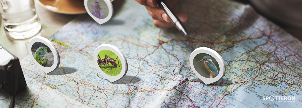
We are always at some place - and the map in a Citizen Science App reflects this connection. In Citizen Science, the location of a contribution often plays a central role. With the rise of Smartphone technology and integrated sensors, GPS, and services, Citizen Science could reach a broader public and become an integral part of a participant's daily life. With a mobile App right at hand, a user submits the data directly on the location, and at that moment, an observation or impression occurs. With this immediacy, the GEO location plays a crucial role in natural science and environmental monitoring as well as in many projects from social sciences, humanities, and other scientific fields.
As always: Digital Ethics and User Privacy matter
Every map type has privacy and data safety in mind. On the platform's Citizen Science optimized IT infrastructure, we run own professional digital map servers, and when implementing external maps, we make sure the source is safe for all participants without making the users just "a product."
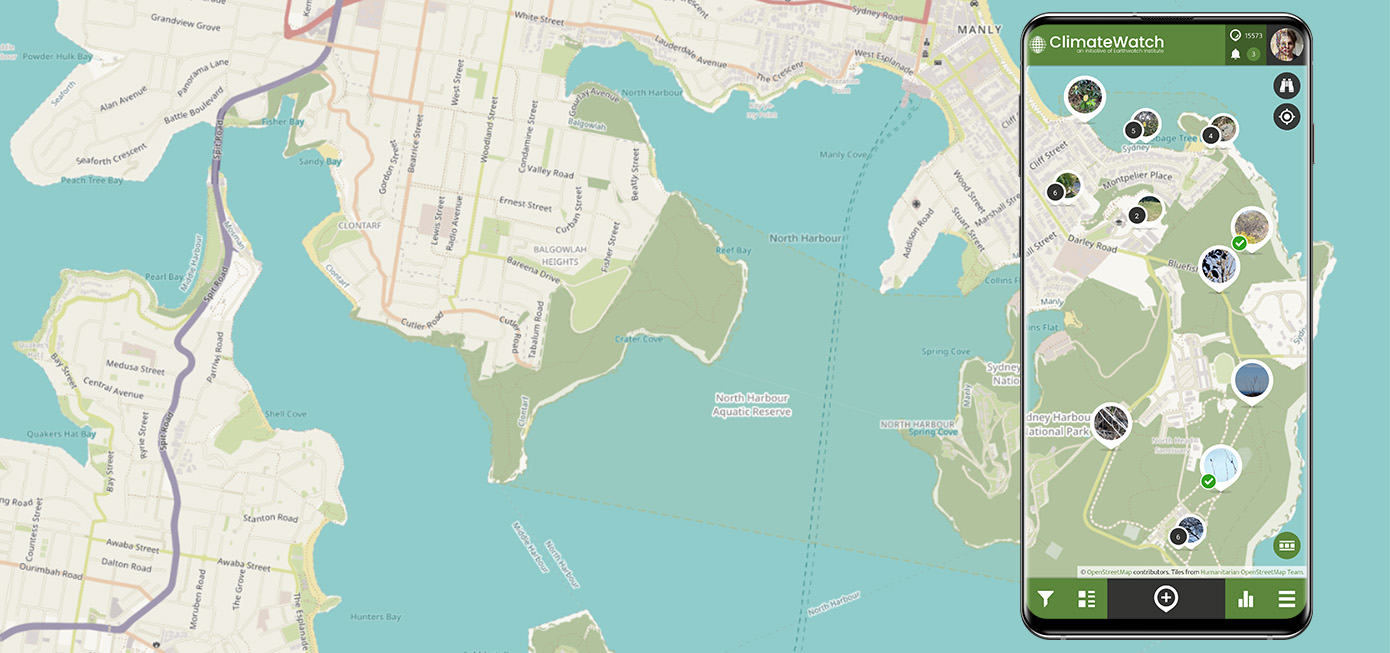
Built-in Map types in Citizen Science App on SPOTTERON
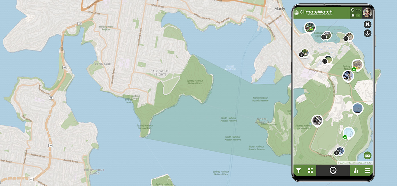
SPOTTERON Bright Map Style
The bright map is our standard map style for the Citizen Science Apps. It features a clean layout emphasizing speed and clarity to navigate the map view quickly. The design focuses on vital information, displaying the map's core elements in an easy-to-read way with background-style contrasts. Since many Citizen Science projects related to environmental themes, natural areas and national parks are also prominently highlighted with geospatial overlays.
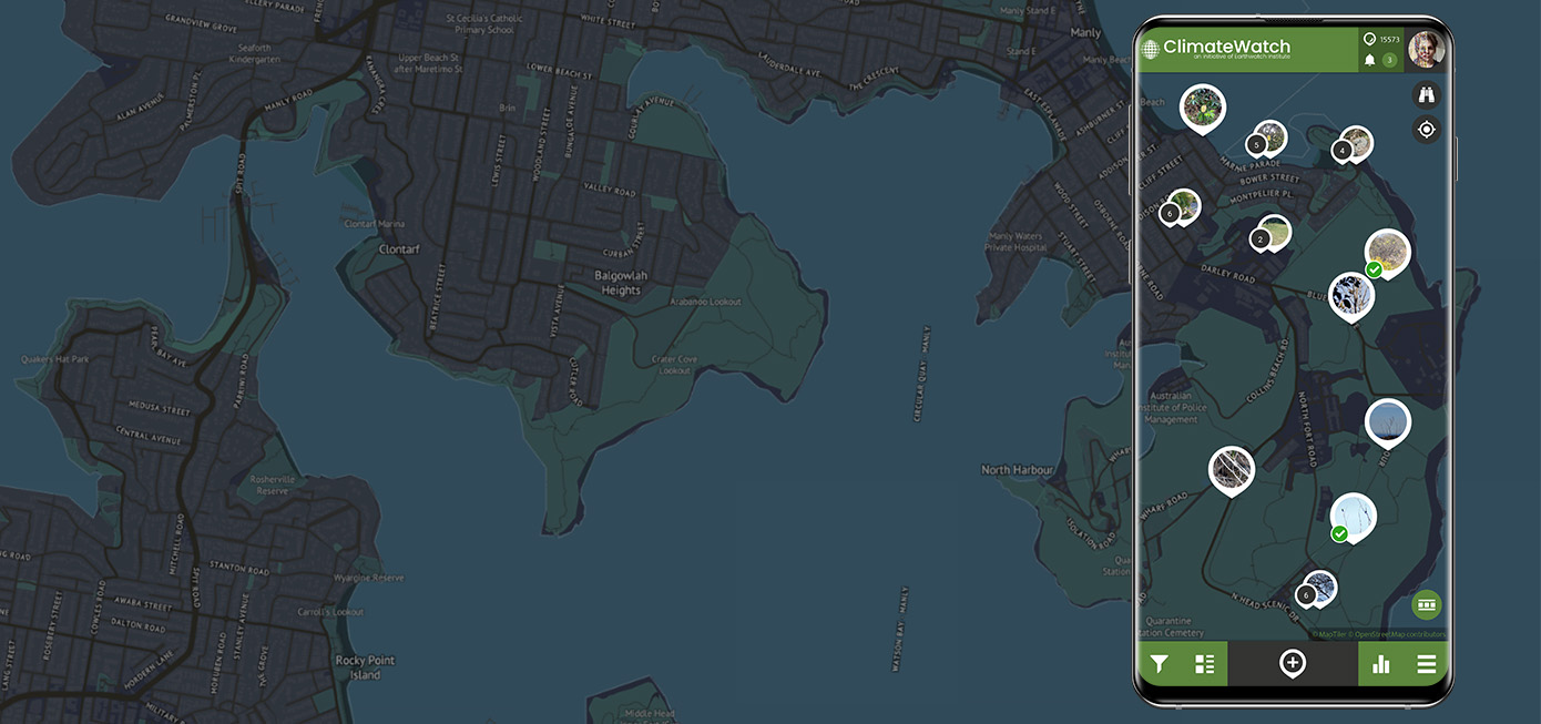
SPOTTERON Dark Map Style
When participating at night times, the brightness of a Smartphone screen can be counterintuitive. For those situations, all SPOTTERON platform-based Apps feature a unique map design with inverted contrasts and dark colors. The dark map style makes it easier to participate on location, especially in Community Science projects about night sky and astronomy observations or about nocturnal animals like bats, hedgehogs, or moth monitoring.
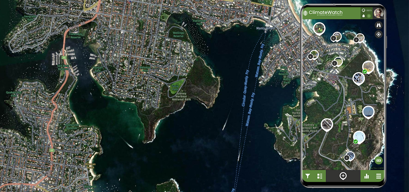
Satellite Map Overlay
In the Map Overlay Menue, users can activate the Satellite View. This photographic terrain view makes it easier to locate observations in more rural or wilderness areas, with less flat map information present. Besides its visual appeal, the Satellite view can also put observations in a better context when seeing the landscape types and environments on the fly. We use Here Maps as the provider for Satellite Maps. This Europe-based service offers better privacy protection than "free" online map providers while maintaining a detail-rich satellite map quality.
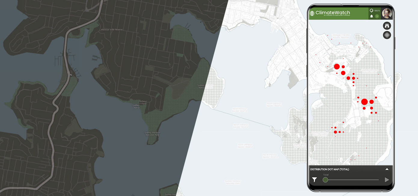
Data Visualization Styles
For the SPOTTERON Data Visualization Overlay, we have designed two particular map types to provide a background layer for added visual information. The Data Visualization Map Styles feature a dark variant for Heatmaps and a bright version for shape-based visualizations like distribution maps or project-specific data visualizations. With the requirement to blend with data visualization elements, the style is reduced and in lower contrasts.

OpenStreetMap (OSM)
What Wikipedia is for knowledge, Open Streetmap is for open data maps. Thousands of volunteers worldwide work together to create detailed maps that are non-commercial but still of high quality and detail. We have implemented different Open Streetmap styles for Citizen Science that can provide participants with personal choice and commonly known styles.
OpenStreetMap Regular
The regular Open Street Map is a good contrast, more colorful map style optimized for conveying map information quickly.
Humanitarian Style OpenStreetMap
This variant of Open Streetmap is designed to be used as background in applications to display information on top. We utilize HOSM as a standard map in the Web-App of every project and as a user-choice map style in Smartphone Apps of projects.
A diverse selection of Map Types supports Data quality and User Motivation
When adding a broader collection of map options ready for participants, a Citizen Science App adds a layer of personalization and readability. Maps are the core element of GEO-location data-based Citizen Science, and by utilizing different map styles and types, the data quality and user experience can be improved. On SPOTTERON, we stay true to the concept of offering users privacy-safe choices and high flexibility for projects. The extendable range of map types supports that.