Citizen Science Apps & Observatories

With the SPOTTERON Citizen Science Platform (www.spotteron.net) we offer a customizable and affordable system for applications in the areas of Citizen Science, environmental protection and volunteer monitoring. In cooperation with research projects, we develop independent smartphone apps for Android and IOS, interactive applications for browsers such as map applications or citizen science games, and provide a stable and reliable platform for projects. 

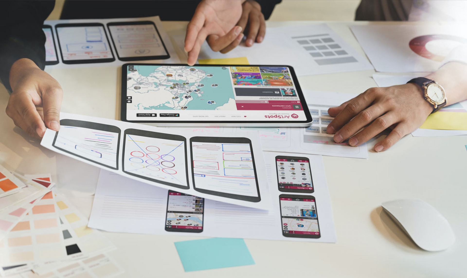
 All applications on the SPOTTERON platform are looked after and maintained by us during the entire run-time in order to be able to guarantee the best possible stability, compatibility and security for citizens and scientists.

With over 6 years of experience in the field of Citizen Science Apps and over 20+ years of know-how in design, development and online media, we offer broad expertise for new or established research projects in the field of Citizen Science. 
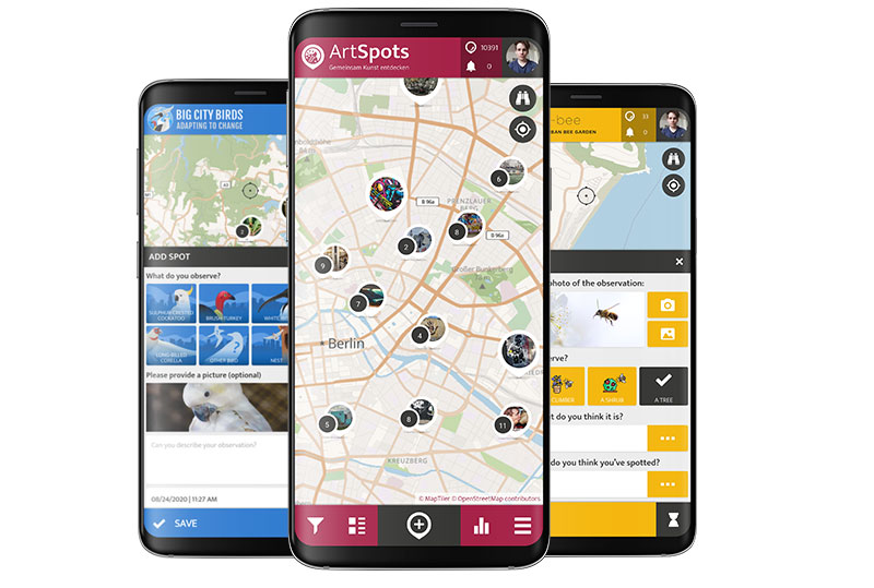
 

Smartphone Citizen Science App Feature

SMARTPHONE APPS

Custom apps for Android and iPhones with all SPOTTERON platform features
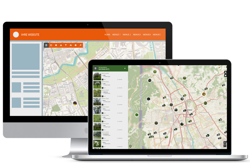
Interactive Maps in Citizen Science Apps

INTERACTIVE MAPS

Desktop maps for your own project homepage with full functionality
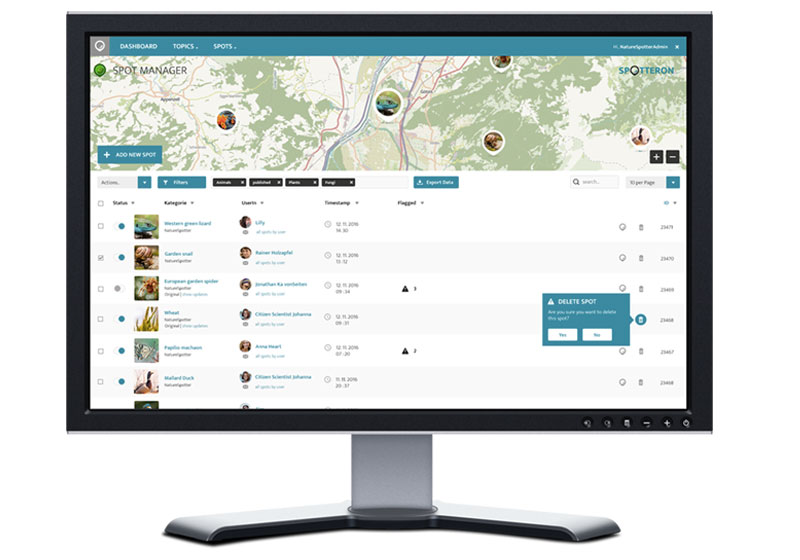


Administration Interface

ADMINISTRATION

Intuitive admin interface for maintenance and data download


Citizen Science Project Website

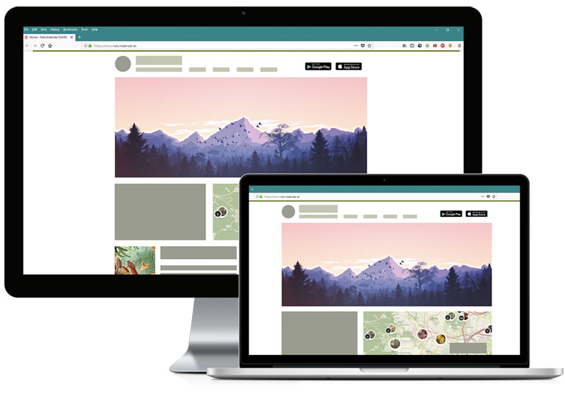
Optional: PROJECT WEBSITE

CMS based website with high-quality design for desktop and mobile
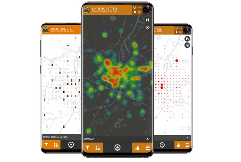
 

Smartphone Citizen Science App Feature

DATA VISUALIZATIONS

Interactive, in-App Data Visualizations for Citizen Science projects
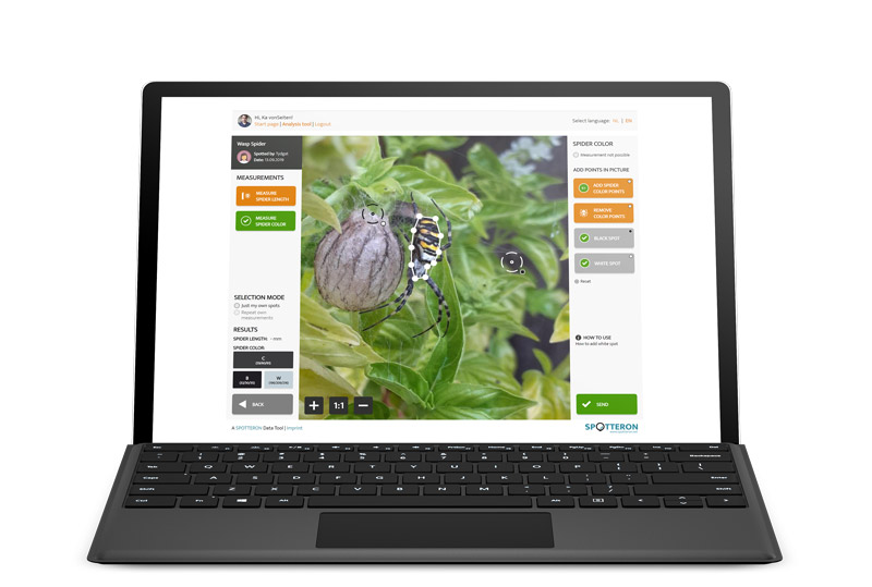
Interactive Maps in Citizen Science Apps

DATA ANALYSIS TOOLS

Crowd-based Data Analysis Tools, connected to the Citizen Science App


More in this category:
Interactive Science Games »

Short News

  • In the course of our Horizon Europe partnerships, we have developed a new data infrastructure to extend on interoperability, data exploration, and data re-use: the SPOTTERON GeoServices Platform. The platform allows data to be referenced with external data layers, be combined with digital twin infrastructure, and used for exploring geo-spatial relations. If you want to utilize the toolkit in your research project or for Citizen Science Apps, please get in contact!

    in Shortnews
  • It was a wonderful time at the European Citizen Science Association Conference in Finland. See our reflections in the blog

    in Shortnews

Newsletter

Please enable the javascript to submit this form