
SPOTTERON
Responsive Web-Design
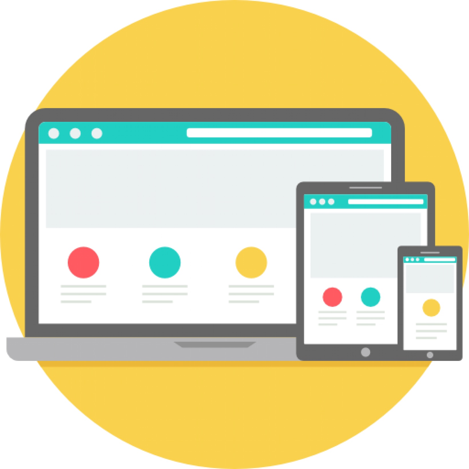
The design is compatible with smartphones, tablets, and all monitor resolutions, up to Full HD.
App Production Process
An established procedure is in place for designing and producing a project's Apps. The multi-step process spawns from drafting the input dialog for data submissions and collecting all App contents in a central document. From a Kickoff Meeting to App Release, we work closely with your team to design and develop your interactive Applications and digital toolkits from a text representation over visual previews to a final App prototype.
App Updates & Maintenance
Our team takes care of all Applications running on the platform, and we provide regular App updates.
Data Administration
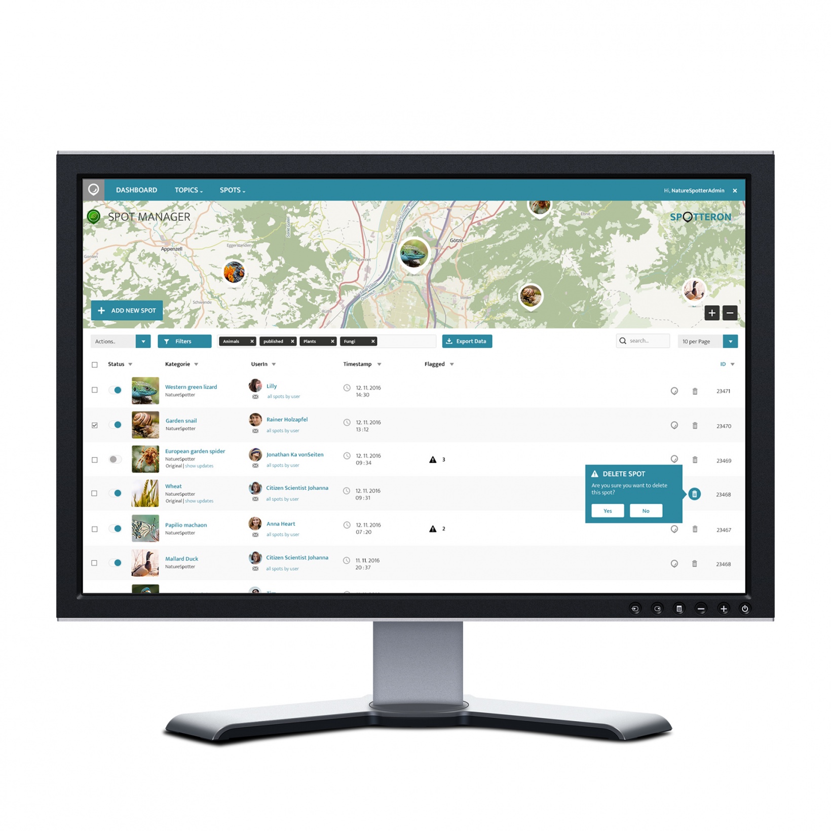
A central hub for data and community management, communication, and data exports
Web-Application
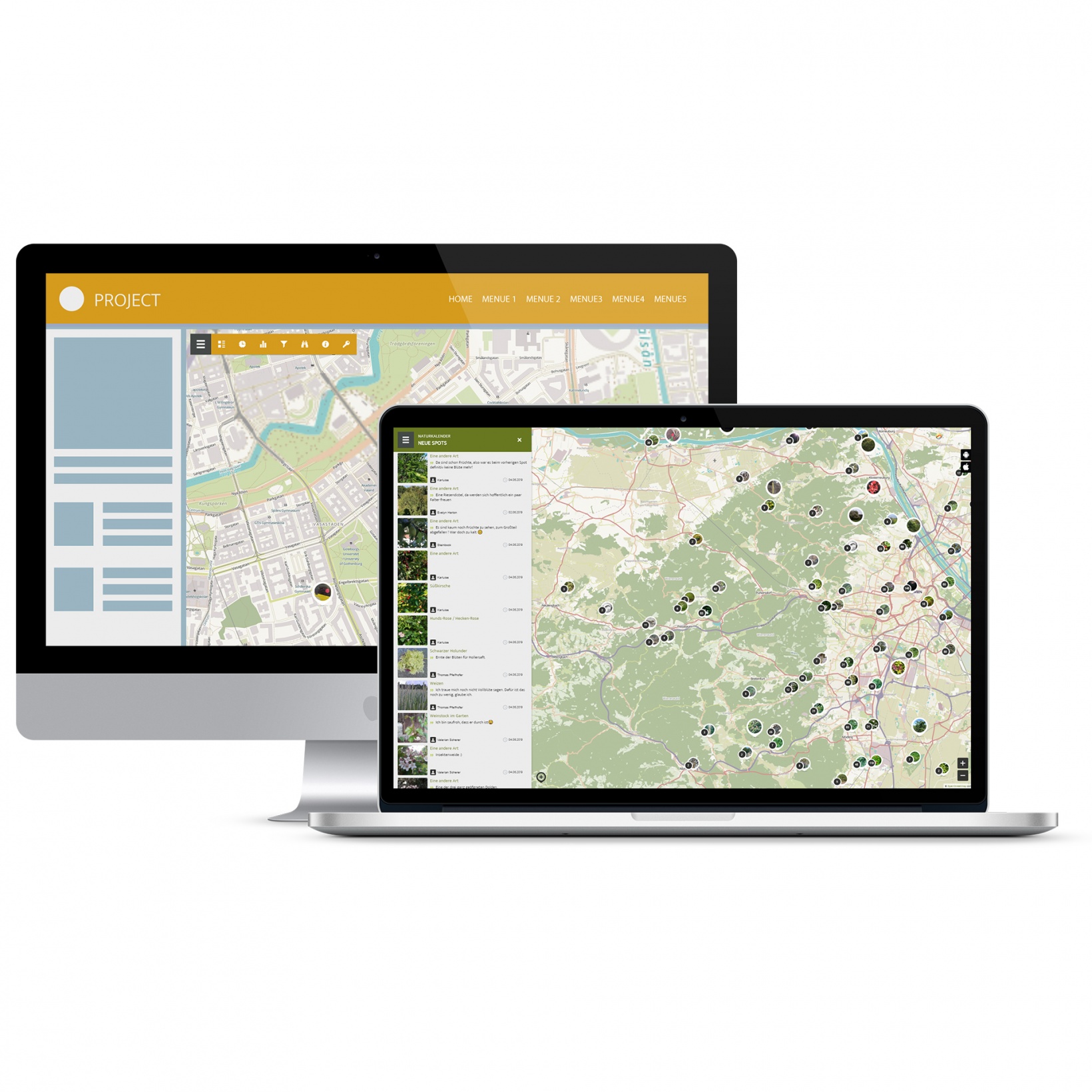
Browser-based App for participating in the project on laptops or desktop computers
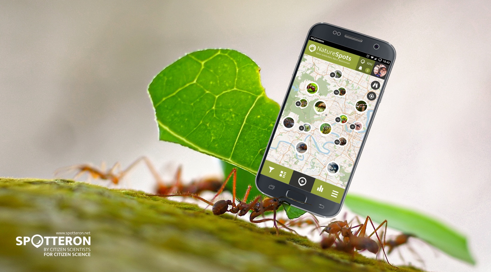
Smartphone Apps
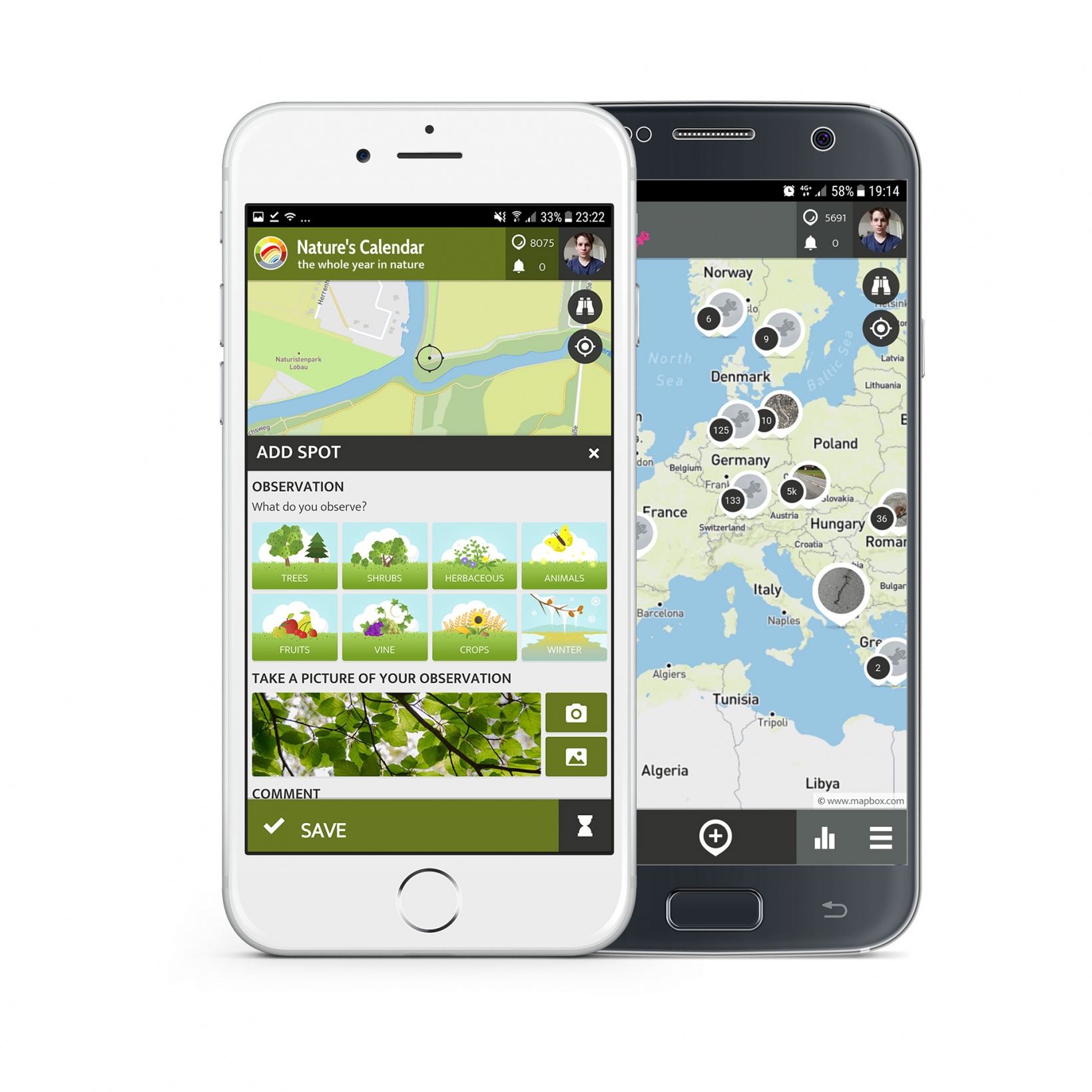
Custom-tailored project Apps for Android and iPhones with many included features
Slider

Number input via sliding interface element
Taxonomy System (Wikidata Connector)
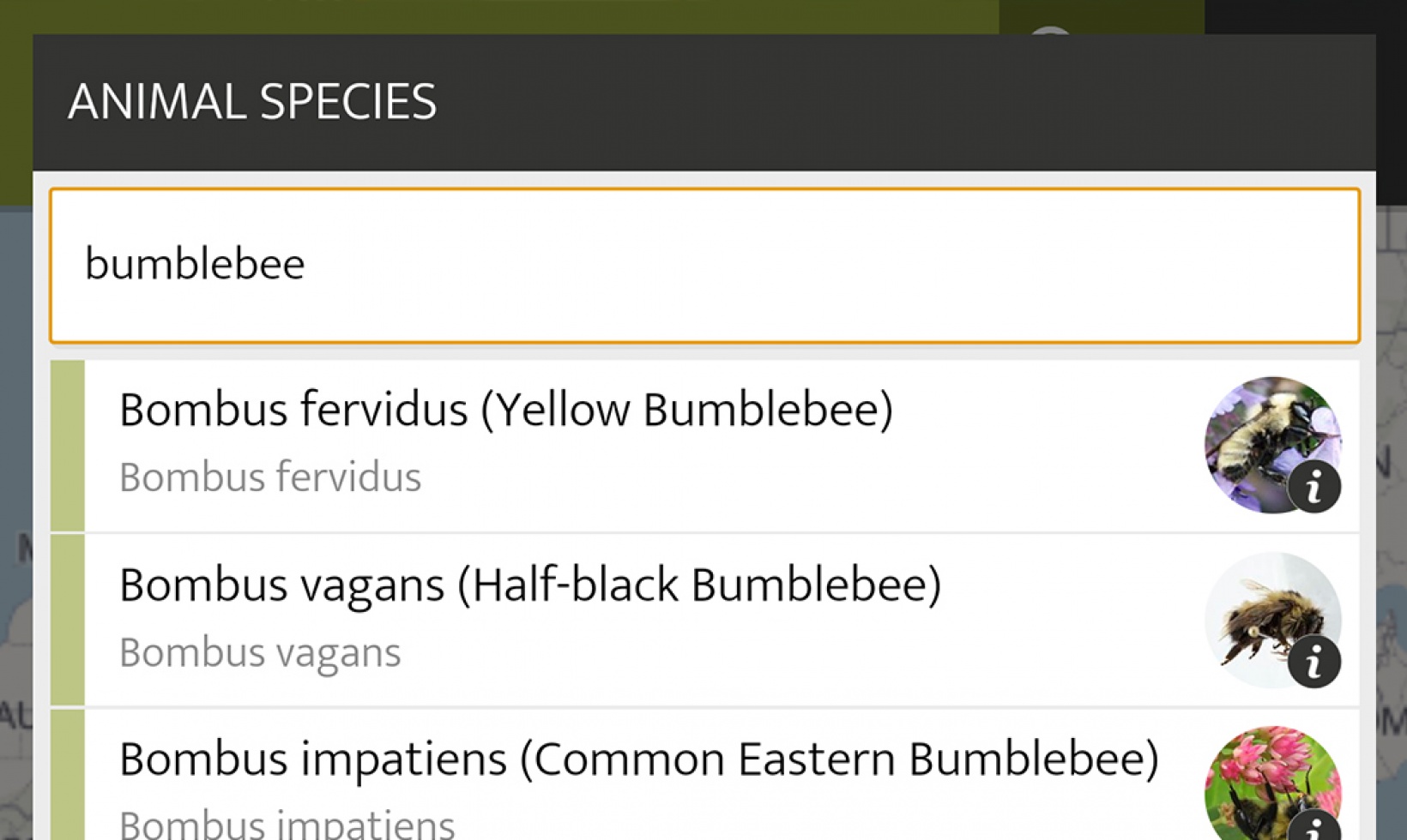
Taxonomy selection based on user input via WikiData for species or other taxon information
Autocomplete I/O
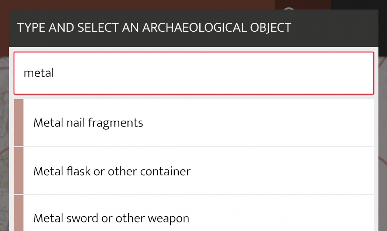
Selection of options via suggestions on user input (autocomplete) for large amounts of data options
Spatial Data Input
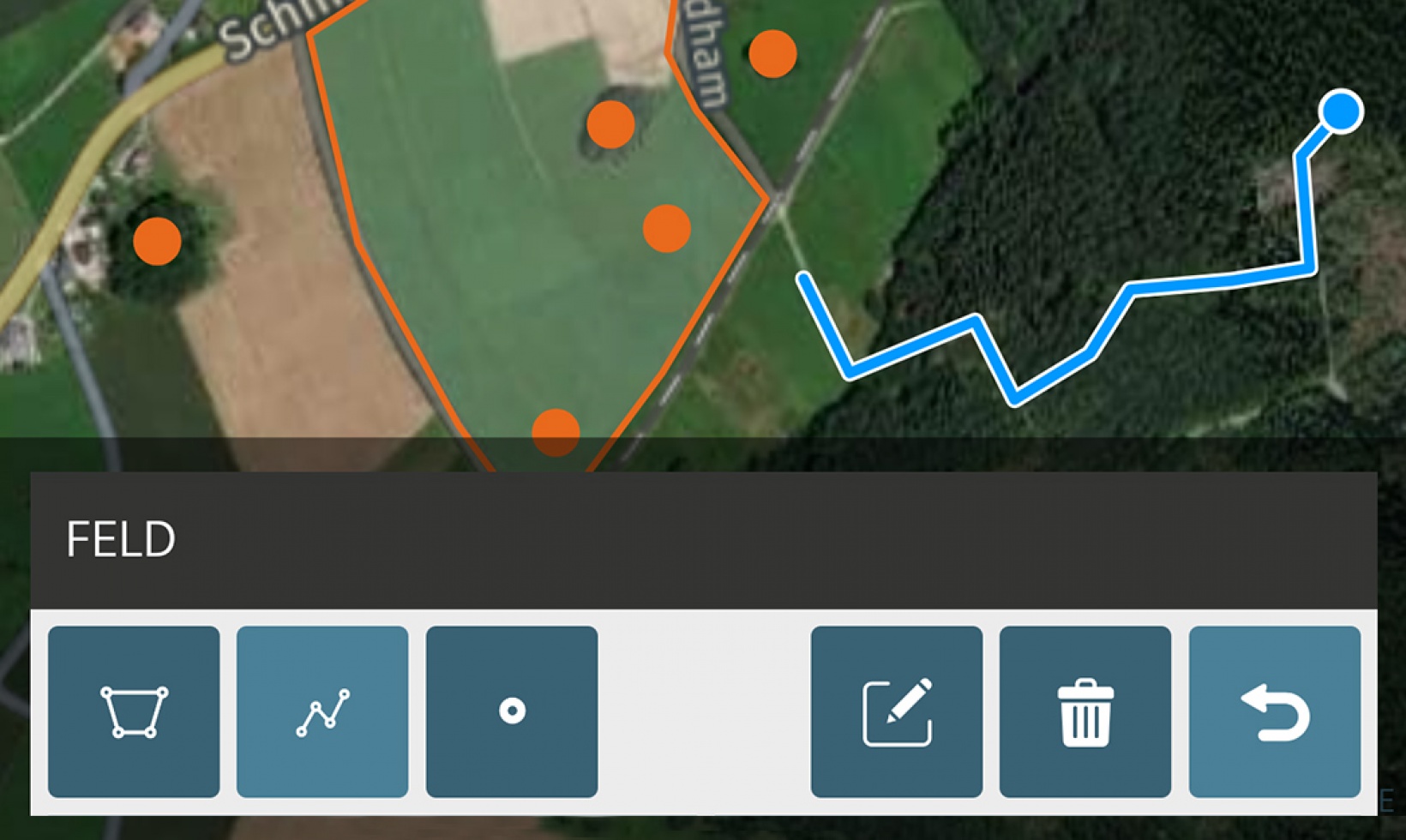
Drawing of geographical data as lines, areas or dot paints