Live Route Recording in Citizen Science Apps
Every so often, the journey is the reward. When it comes to Citizen Science projects that include data about paths and routes traveled by citizens in the research, recording such geospatial data live is a crucial feature. Projects from areas like environmental health, urban transportation, or social science studies can benefit from being able to enable participants to record live routes. Which paths are taken every day by citizens, how fluently do they reach destinations, or how do people feel about their travels? But even science projects about biodiversity or ecology can utilize routes, e.g., observational transect setups or to see which paths app users take while exploring nature.
Moreover, in a smart city approach, including citizens directly, such feedback can greatly support the urban planning, environment design, or city developments, from bike trails to public transport. With the option to provide direct location feedback while recording a route. Users in an interactive Smart City app can submit data about real life impacts, such as the likability of public places or problems at special locations causing discrimination effects for marginalized groups.
Data on the Go
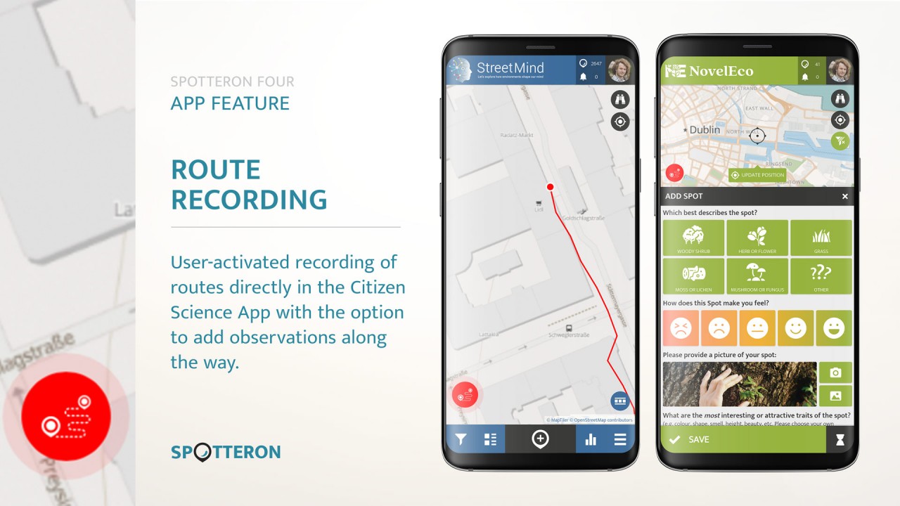
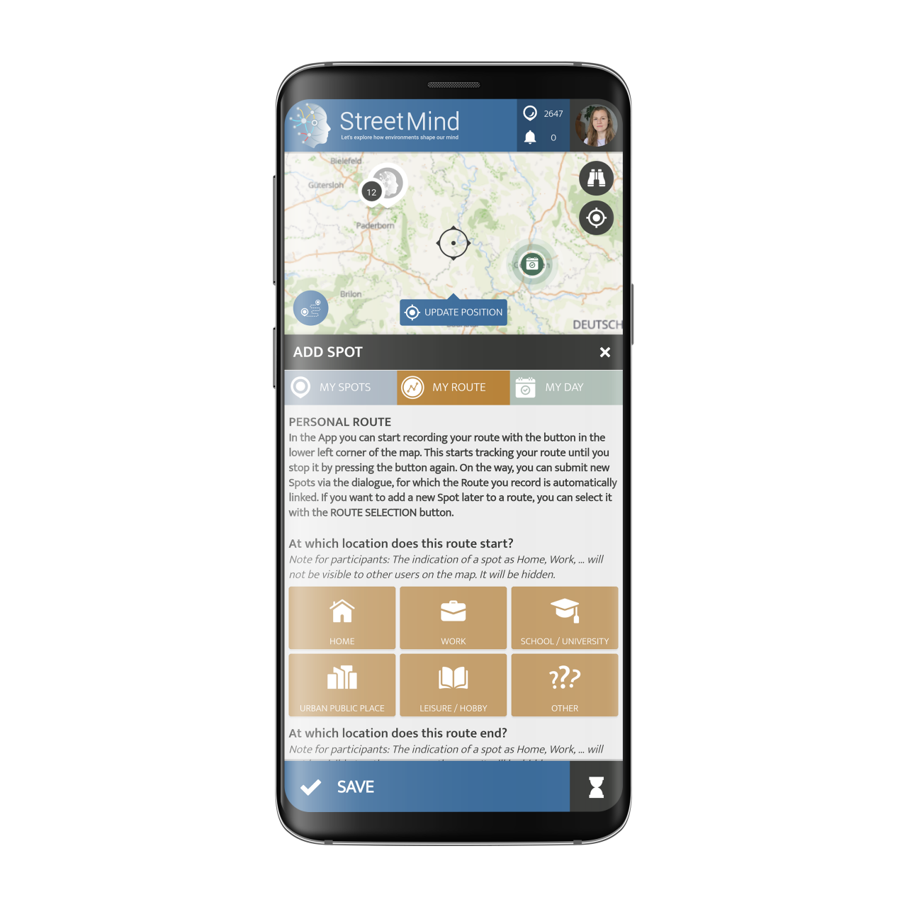
Together with the projects on the SPOTTERON Citizen Science App platform, we have developed a new feature for recording routes and paths while on-the-go. With the press of a button, participants can start to record their routes live in the app, like we know from running or fitness apps. The new feature is completely under the user's control via a new interface, that manually allows the start of the recording of the user's GPS track. The active path recording is always visible in the phone's status bar and status drawer, from where it can also be interacted with. Each user has full control over their route recording, and an activity can be stopped at any time.
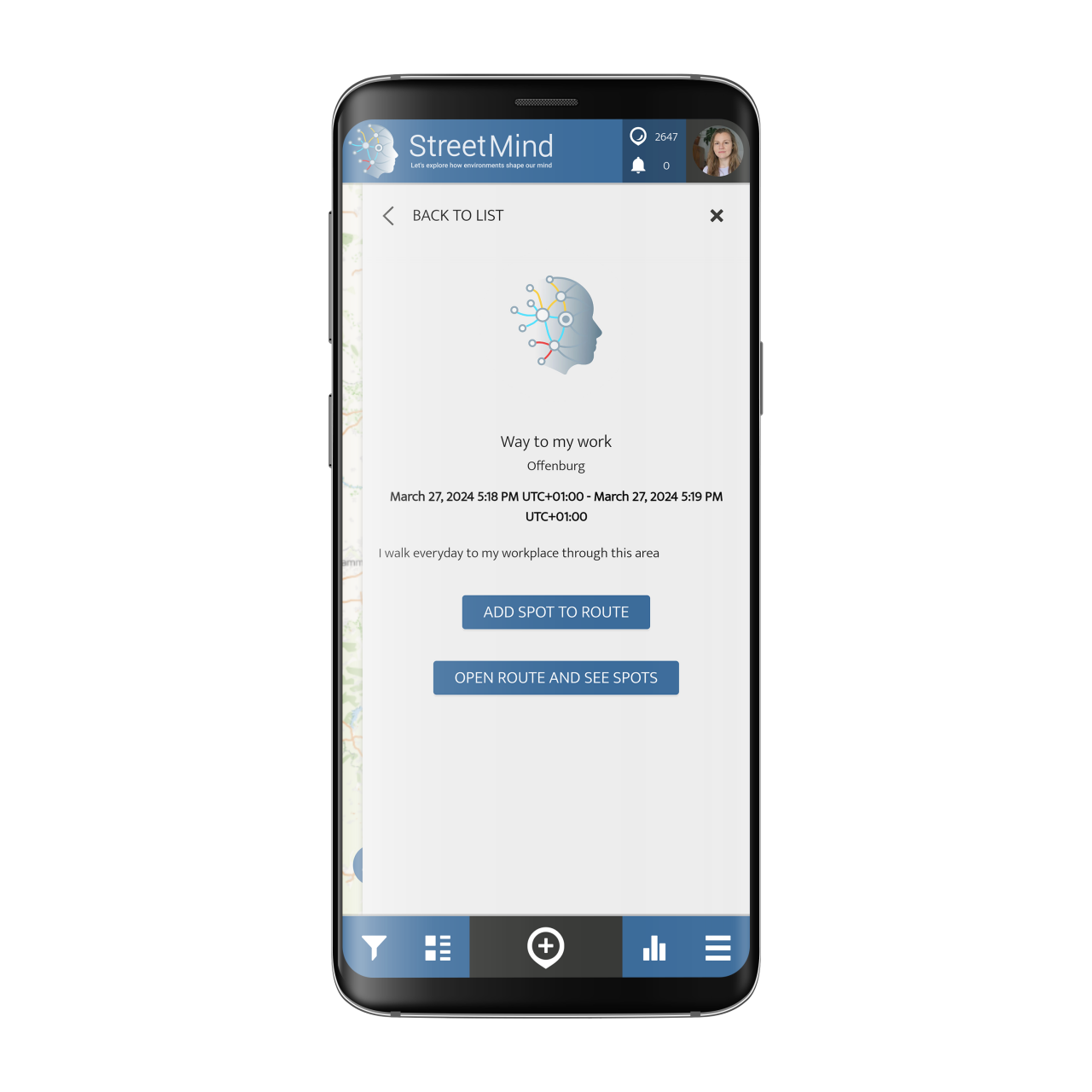
But recording the route is not everything. We have integrated the system into the SPOTTERON platform's project activity system, which enables users to additionally submit observations linked to a route recording. This means that participants can record their motion while still adding observations about their surroundings along the way. These data uploads are linked with the recorded routes in the data export. By that integration into the platform's project activity system, projects can ask participants to provide location quality feedback or upload, e.g., species observations while going on a walk in their city. The recorded routes are due to performance and privacy reasons only visible to the author user, and the project team in the data export.
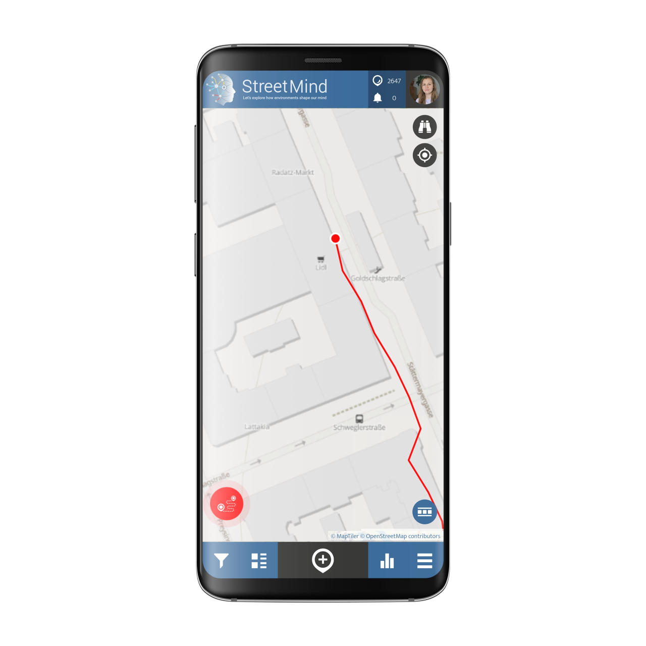
The Route Recording Feature in the StreetMind project
StreetMind is a project by the University Medical Center Schleswig-Holstein and the Kiel University Institute of Medical Psychology and Medical Sociology. It contributes to a more profound understanding of how environmental factors like urbanity or climate change influence how individuals across Europe and the world feel, act, and behave. Participants share their daily experiences of their surroundings and the environment where they live, work, and interact. By recording their daily life routes and occurring observations, scientists research how people feel in certain places. Is it safe? Is it crowded? Does a particular area influence the sense of well-being? Are people more active in certain areas? All these questions are part of StreetMind's environmental health research, which is part of an international Horizon Europe project about medical research. As a medical study in the pocket with daily contributions from participants, StreetMind breaks ground in putting medical research out of the shadows and provide a toolkit, in which stakeholders across Europe work together for a more profound understanding of urban environmental effects on our psychology and personal well-being.
Integrated Usability of the new Route Recording feature on the CitSci App Platform
While on the way and actively recording the route, the Citizen Science App's interface does show an animated activity indicator. The user can add new data points of observations, alongside photographs, which are then linked to the GPS track data with the track ID stored. Through this non-interruptive design, it is, e.g., possible to record a route while adding observations of occurrences to it. This possibility can e.g. be used to better understand the path a participant takes, while having observational data connected to the recorded route. This scenario can be used in a multitude of ways, as a component in a BioBlitz, having walks together with CItizen Scientists during a workshop, to better understand Citizen movement and e.g. record obstacles or for dynamic transects, on which a natural observer walks the same route every day and record species sightings.
The Route Recording funcitonality integrates smoothly into the CItizen Science App intrface (GUI). Users are infomred with strong colors if a route recording is ongoing and the interface button is animated and present always in the view of the App. With just a press on the button, a route recording can be stopped. Furthermore, an active route recording is always present in the Smartphone's status bar as a system notificaton, with which a user can also interact to jump back to the app and to stop a recording when finished.
Pre- and Post-Survey Options for Route Recording Activities
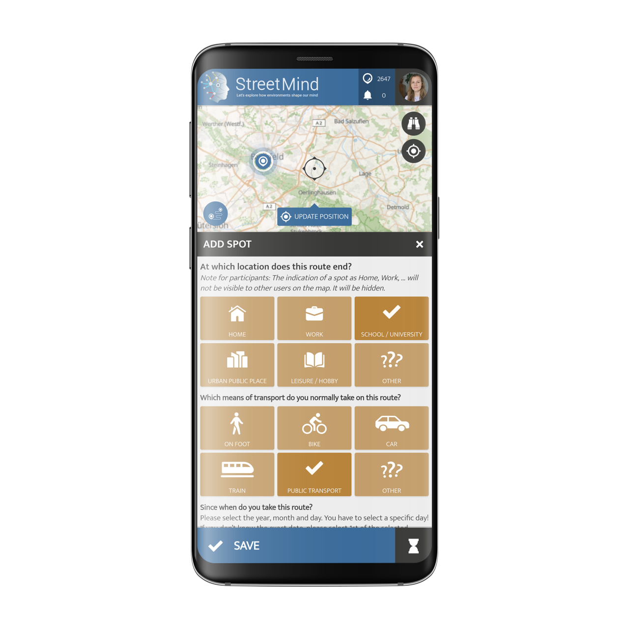
With the help of projects on the SPOTTERON Platform, we have built an additional functionality into the Route Recording toolkit, that extends the options for data inputs widely. With a Pre- and Post-Survey option, projects can first ask the participant a set of questions before the activity starts. During the movement, the Citizen Scientist can then document observations along the way, like adding species sightings, or giving qualitative feedback about locations. When the participant stops the route recording, a new set of questions can be implemented into the Citizen Science App. This Post-Survey questionnaire can, e.g., ask about experience made on the trip, or if the participant's view on a topic has changed after having had the experience.
History: Study on Citizen Routes in Copenhagen has enabled its famous Network of Cycle Paths
A great example of what is possible with path-tracking data is Copenhagen. In 1967, the city started to document and collect data on the daily lives and routes of its citizens - without mobile Citizen Science Apps or digital participation for sure. But despite of the differnt kind of tool, from then on, cycling facilities and connections were developed so well that the entire city is crisscrossed with a dense network of cycle paths. In addition, work is constantly being done on safety for cyclists and pedestrians. Until now, Copenhagen has had comprehensive information and a good overview of its city — where people cycle a lot, which ways do they go, where do accidents happen, and where is a reduction of cars and exhaust fumes needed.
The Route Recording feature on SPOTTERON brings that to a modern level. With high usability, privacy-safe technology integration, and direct user control, recording routes in Citizen Science is now available for all projects on the platform to use. The new feature offers a unique range of possibilities for various Citizen Science projects. For further details or a comprehensive presentation of this feature, please do not hesitate to contact us. We would be pleased to arrange a meeting to explore its capabilities and potential benefits for your research.
Related Posts
By accepting you will be accessing a service provided by a third-party external to https://www.spotteron.net/


