Preview: Offline Maps & Spots for Citizen Science Apps

Preview: Offline Maps & Spots for Citizen Science Apps

Citizen Science often happens out in the field where network coverage can be weaker. That's why it can be especially helpful and pratical to pre-download map sections and save them locally on a smartphone for excursions and hiking trips.

The new offline maps in all SPOTTERON apps offer exactly that. In a separate panel you can define the map section, name it and save it. On top you can also download spots to be able to carry out spot updates without internet connection.
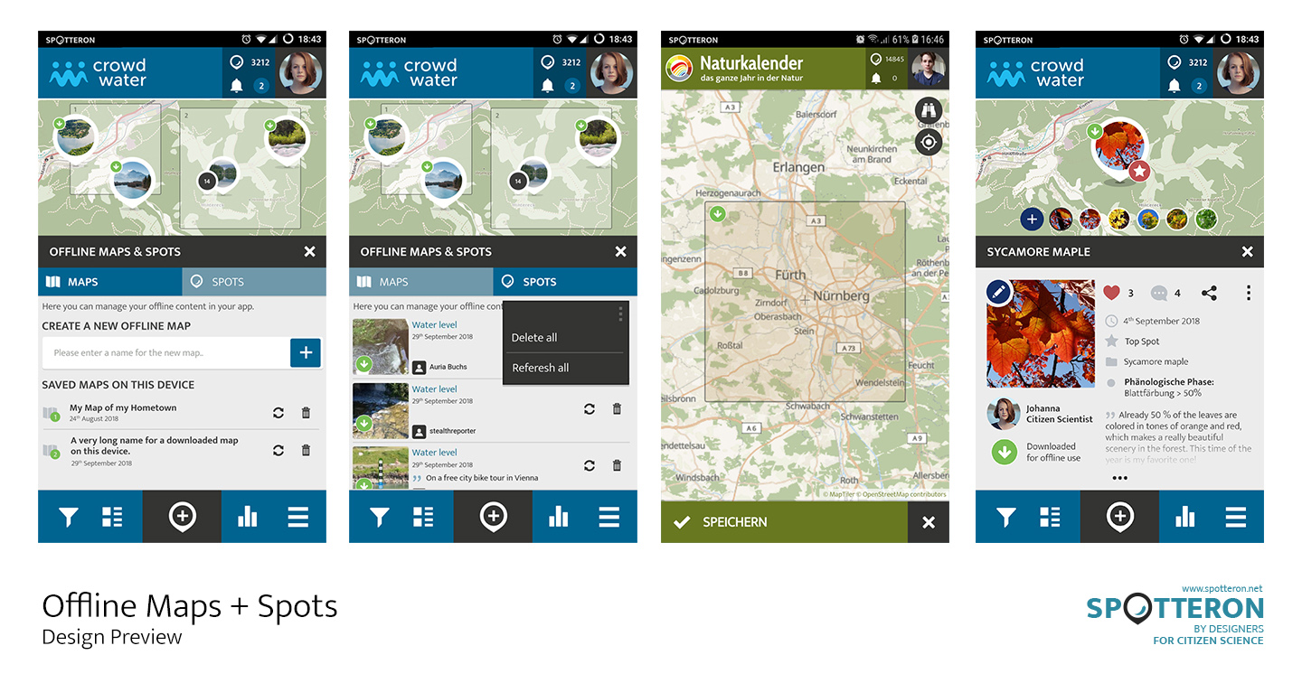
SPOTTERON OfflineMode Main File

Along with the new offline functions we rented a professional map-server for the Citizen Science apps running on SPOTTERON, which next to it's high quality performance also allows to download map sections.

Citizen Science Summer School 2018
Impressions from the European Researchers Night in...

Related Posts


Comments

No comments made yet. Be the first to submit a comment
Already Registered? Login Here
Guest
Monday, 20 March 2023

By accepting you will be accessing a service provided by a third-party external to https://www.spotteron.net/

Short News

  • A new paper from the Horizon 2020 project IPM titled "Genetic variability of Metarhizium isolates from the Ticino Valley Natural Park (Northern Italy) as a possible microbiological resource for the management of Popillia japonica" has been added to our page. Find this and other Citizen Science related publications on the SPOTTERON Papers & Publications section.

    in Shortnews
  • Three new papers on the SemantiX project titled "Accessing Multiple Semantic EO Data Cubes in One Graphical User Interface", " Think global, cube local: an Earth Observation Data Cube’s contribution to the Digital Earth vision", and "Semantic Querying in Earth Observation Data Cubes" have been added to the SPOTTERON paper section.

    in Shortnews