Two new features: Top Spots & Meta-Infos

Wednesday, 03 October 2018 21:08

We recently added two new feature to SPOTTERONs ever extending 'feature ecosystem'. The two most recent additions 'Top Spots' and 'Meta-Infos' can enhance better data quality and more..

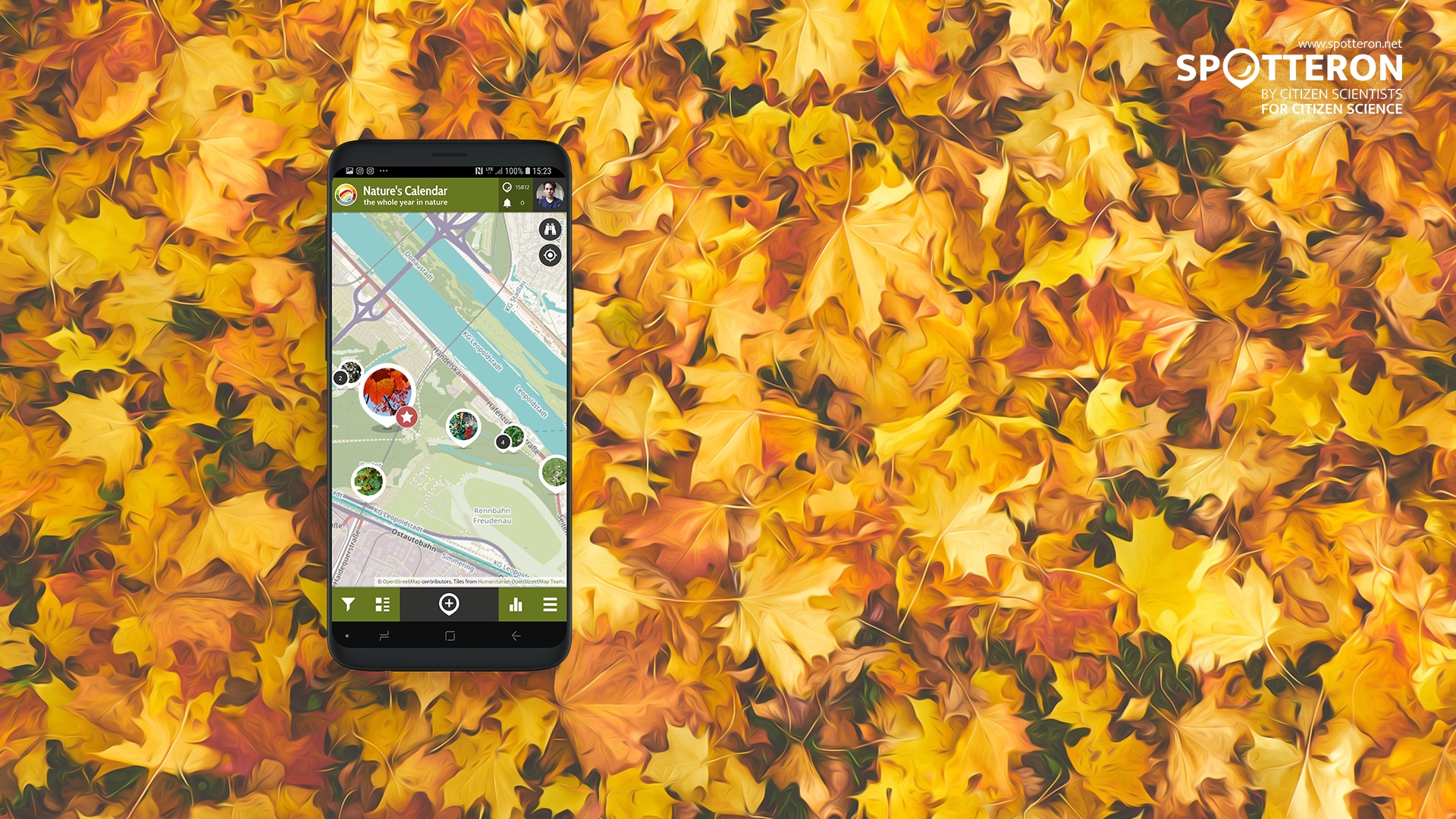
Top Spots: One feature, many advantages

Project administrators can now mark any spot as a so-called 'Top Spot' in the administration interface. This leads to a star appearing by the spot marker or a custom designed icon in the project's apps in realtime. The 'Top Spot' feature can be used in different of ways according to the project's needs.
For example they can be used as tools to enhance longterm user motivation and to support better data quality of submissions. When Citizen Scientists contribute high quality data, flagging their spot as a 'Top Spot' can be used as a sign of recognition and reward, thereby giving them a positive feedback in a very easy and time efficient way. This will likely boost their motivation and can also give them a better understanding of how to collect spots with a high data quality. Because the 'Top Spot' icon can be seen by all Citizen Scientists in the project, it also shows the entire community examples of especially valuable data.

But these two positive effects are not the not the only ways to make use of this feature. In case a project collects data on a certain development over time, 'Top Spots' can also function to highlight, where an update may be especially valuable and/or needed. This way Citizen Scientists can be informed and encouraged to add a valuable piece of data to the project.

WhatsNew in a Row

Meta information: latin species names, other languages, numerous possibilities

The Meta-Infos are displayed directly in the selection lists of project apps to provide valuable information to Citizen Scientists when recording their observation. They are displayed in smallerer letters below the main selection name can be a latin species name for example, but also a different name or whatever can be phrased in two to three words. This way you can also integrate a way for your Citizen scientists to learn something or better define their observation. 

Projects & Apps open for Co-Use on SPOTTERON

App Icon
Social initiative Data Collection App
SPOTTERON

ArtSpots is a community-built art atlas. Through the App, people interested in various art forms like street art, historical or contemporary art, photography, architecture, and more can put their art observations on the map and discover art spots in their city or while travelling. The art community in the App allows exchanging with other like-minded people and contributing to a worldwide art collection.
Learn more about
ArtSpots
App Icon
Horizon Europe Citizen Science App

With the COSEA App, Citizen Scientists can observe marine environments, document coastal habitats or species, and report on pollution, infrastructure and the blue economy. Their contributions on the map and activity in the app will help scientists better understand the impacts and drivers of marine factors to protect and foster a healthy relationship between humans and seas.

Learn more about
COSEA | Collaboration for Effective Sea Action
App Icon
Environmental Citizen Science, Data Collection App
SPOTTERON

NatureSpots is a non-commercial and free project to discover nature together. In the app, nature photos and sightings of animals, plants or mushrooms can be shared with the community on the map. The app is a new initiative for observing nature and taking part is very simple and straightforward. The app is free of advertising, does not track users and takes digital privacy seriously.

Learn more about
NatureSpots
App Icon
Social initiative Community Engagement App
SPOTTERON

The new citizen participation uses "Citizen Science" in their hometown and nationwide to get User's feedback on places. As a result, citizens are empowered to become active in a city worth living in to collect and share data themselves and to interact with scientists. This enables them to recognize the consequences of sealing, heat, water shortages, and a lack of biodiversity, and generally, how places in their own environment affect us all.

Learn more about
CIVO Citizen Voice
App Icon
Horizon 2020 Invasive Species Monitoring App

The IPM-Popillia Horizon 2020 project aims to address the challenge of a new risk to plant health in Europe's agriculture and food safety: the invasion of the Japanese Beetle, Popillia japonica. This invasive species was introduced accidentally to mainland Europe in 2014 and can quickly spread by transportation and trade. As a species with a wide range of feeding plants, P. japonica threatens the entire agricultural sector, urban landscapes, and biodiversity in invaded areas.

Learn more about
IPM Popillia | Integrated Pest Management of the Japanese Beetle
App Icon
Environmental Community Engagement App

Fridays for Future see itself as a horizontal, grassroots grassroots movement that acts apolitically and refers to science for the facts. To engage the global population more, this app was developed using SPOTTERON. The aim is to find out how the population perceives the climate crisis and which positive and negative emotions are associated with specific topics related to biodiversity and climate crisis.

Learn more about
FRIDAYS FOR FUTURE - Climate App

Are you interested in co-using existing Apps? Get in Contact!

Get in contact for co-use here


Short News

  • New study from BiciZen project: "BiciZen: Lessons in the Development of a Crowdsourcing Mobile App to Make Cities More Bikeable" published in Journal of Participatory Research Methods. More studies available under the publication page here.

    in Shortnews
  • Roadkill project has made wonderful short videos for the citizen scientists! The videos include the Roadkill App functions regarding how to confirm & comment on the spots and how to best take the photos for the project. The videos (in German) are available in the "Österreich forscht" blog here. 

    in Shortnews

Newsletter

Please enable the javascript to submit this form