Upcoming app feature: Citizen Science Events

Wednesday, 09 October 2019 18:20

A brand new feature for all Citizen Science apps on the SPOTTERON platform comes with the next release version: Citizen Science Events. With this new extension, the project teams can publish events like workshops or field trips directly in the Citizen Science app. Secondly, it is possible to create area events, to e.g. highlight, where more observations by the Citizen Scientists are needed.

Earthquakes and Citizen Science

The Austrian Central Station for Meteorology and Geo-Dynamics (ZAMG) Austria has funded the extension. They now already run their second project on SPOTTERON after the successful phenology app "Nature's Calendar": QuakeWatch Austria.
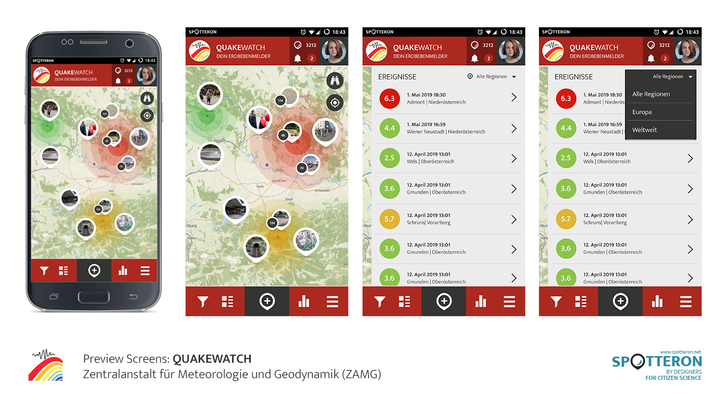
The ZAMG's geodynamics division maintains the governmental earthquake measurement infrastructure of Austria and processes live data from quake sensors all over the country. In the upcoming QuakeWatch app, data about occurring earthquakes will be now additionally collected by the public.

To display occurring earthquakes in the app of the project, we have developed a new custom extension. Earthquakes are "events", which take place at a distinct location and at a particular timeframe. To reflect that visually, we have created a new overlay, which displays current events in circular shapes. The width and colour of a circle are calculated in real-time by the magnitude and depth of an earthquake. By connecting via a custom API, we display the earthquake data in real-time in the app.

QW SPOTTERON PreviewScreens 01 1440px


Designing it openly: Events for every Citizen Science app

Since not many Citizen Science projects have similar real-time data available, we have taken the whole concept a big step further. New features should always be of use for all other projects on SPOTTERON, too. That's why we have created a new section in the SPOTTERON administration interface, in which events can be created manually. By setting up a location and some additional information, scientists can create a new event with just some clicks. More options like a cover image and an end date are available.

But events are not only happening in an area on the map - often they are on just one location, like for example a workshop, a talk on a conference or simply a community meet-up. For these event types, we have created a second option: if an event has no given radius, it is displayed as a point event. The point events have their own distinct marker style.

Every event can be opened in the app with just a touch and displays all the information of an event. From the date and time to a description, which can also include links to other homepages, all event Infos are displayed in a new panel. Furthermore, radius events have a button, which shows "Filter spots by this event". By pressing the button, a filter is applied to the map view. Just the spots, which are in the radius of the event, are then displayed on the app's map view. To make this work, we have completely reworked the current filter system and extended it by new indicators that filters are active.

In the main menu, a new item provides access to the list of all current events in one project. This list view is chronologically sorted and also shows the current events cover images as icons. In a second panel called the event archive, all past events can be accessed.

As always, this new extension is shared with all other Citizen Science projects on the SPOTTERON platform for free. The event extensions on SPOTTERON increases the possibilities scientists have in the Citizen Science app of their projects. The radius events can, for example, be utilised to highlight areas, in which the Citizen Scientists should contribute more observations. Point events can be used to include the community even further in the Citizen Science project.

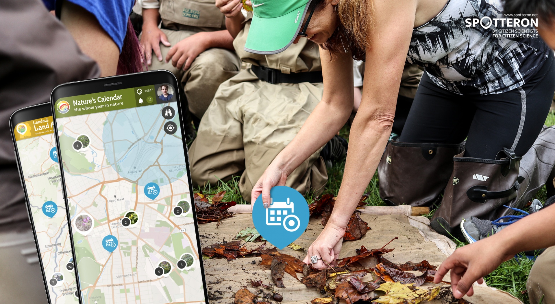
Citizen Science app screenshots (Nature's Calender ZAMG & Quakewatch app design)

Projects & Apps open for Co-Use on SPOTTERON

App Icon
Social initiative Data Collection App
SPOTTERON

ArtSpots is a community-built art atlas. Through the App, people interested in various art forms like street art, historical or contemporary art, photography, architecture, and more can put their art observations on the map and discover art spots in their city or while travelling. The art community in the App allows exchanging with other like-minded people and contributing to a worldwide art collection.
Learn more about
ArtSpots
App Icon
Horizon Europe Citizen Science App

With the COSEA App, Citizen Scientists can observe marine environments, document coastal habitats or species, and report on pollution, infrastructure and the blue economy. Their contributions on the map and activity in the app will help scientists better understand the impacts and drivers of marine factors to protect and foster a healthy relationship between humans and seas.

Learn more about
COSEA | Collaboration for Effective Sea Action
App Icon
Environmental Citizen Science, Data Collection App
SPOTTERON

NatureSpots is a non-commercial and free project to discover nature together. In the app, nature photos and sightings of animals, plants or mushrooms can be shared with the community on the map. The app is a new initiative for observing nature and taking part is very simple and straightforward. The app is free of advertising, does not track users and takes digital privacy seriously.

Learn more about
NatureSpots
App Icon
Social initiative Community Engagement App
SPOTTERON

The new citizen participation uses "Citizen Science" in their hometown and nationwide to get User's feedback on places. As a result, citizens are empowered to become active in a city worth living in to collect and share data themselves and to interact with scientists. This enables them to recognize the consequences of sealing, heat, water shortages, and a lack of biodiversity, and generally, how places in their own environment affect us all.

Learn more about
CIVO Citizen Voice
App Icon
Horizon 2020 Invasive Species Monitoring App

The IPM-Popillia Horizon 2020 project aims to address the challenge of a new risk to plant health in Europe's agriculture and food safety: the invasion of the Japanese Beetle, Popillia japonica. This invasive species was introduced accidentally to mainland Europe in 2014 and can quickly spread by transportation and trade. As a species with a wide range of feeding plants, P. japonica threatens the entire agricultural sector, urban landscapes, and biodiversity in invaded areas.

Learn more about
IPM Popillia | Integrated Pest Management of the Japanese Beetle
App Icon
Environmental Community Engagement App

Fridays for Future see itself as a horizontal, grassroots grassroots movement that acts apolitically and refers to science for the facts. To engage the global population more, this app was developed using SPOTTERON. The aim is to find out how the population perceives the climate crisis and which positive and negative emotions are associated with specific topics related to biodiversity and climate crisis.

Learn more about
FRIDAYS FOR FUTURE - Climate App

Are you interested in co-using existing Apps? Get in Contact!

Get in contact for co-use here


Short News

  • New study from BiciZen project: "BiciZen: Lessons in the Development of a Crowdsourcing Mobile App to Make Cities More Bikeable" published in Journal of Participatory Research Methods. More studies available under the publication page here.

    in Shortnews
  • Roadkill project has made wonderful short videos for the citizen scientists! The videos include the Roadkill App functions regarding how to confirm & comment on the spots and how to best take the photos for the project. The videos (in German) are available in the "Österreich forscht" blog here. 

    in Shortnews

Newsletter

Please enable the javascript to submit this form